CartoConsult, the UK’s 3D GIS software company for construction, have been awarded significant funding to ‘blur the lines’ between GIS and BIM for built environment projects.
Project collaboration partners Skanska, BRE, Unit 9, 3D Repo and CartoConsult will help develop a single, integrated and accessible platform where data relating to every aspect of an infrastructure project can be visualised and analysed and then handed over for operation and maintenance.
The Innovate UK funded project, code named ‘Visualise’, will also allow for the sharing of information between stakeholders, bringing together data from BIM, Geographical Information Systems (GIS) and other asset databases and visualised using web based maps, Virtual Reality and Augmented Reality apps.
CartoConsult’s web based software, Carto3D™, will be developed further to look at City Information Modelling (CIM) then driving down to street and building level, fully integrating with 3D Repo’s BIM software.
A full solution for companies tasked with building and operating the UK and global infrastructure around us.
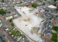
The smart technology will undergo ‘live’ testing on a variety of Skanska infrastructure projects. Highways, Central London buildings and Local Authority maintenance contracts will be used to market test Visualise to mould the product ready for go-to market in 2018.
“Visualise will bring GIS and BIM workflows together, seamlessly. At this point in time, project teams and data are not working efficiently together. Collaboration is key in the government BIM agenda to save costs, create safer environments for the workforce and connect key smart city technologies for greater efficiency for city and building management”, says Tim Hughes, CEO, CartoConsult and Carto3D™.
The award from Innovate UK solidifies CartoConsult’s software offering of bringing location-based technology to smart cities. CartoConsult were also recently awarded a project from Department for Transport (DfT) to partner with Swindon Borough Council and Cisco to deliver a ‘Connected Swindon’ pilot transport project, that will use traffic sensors and cameras to capture detailed traffic movement and then this data will be deployed into smartphone applications for the public and logistics businesses in the town for efficient management of fleets.